Our work has covered projects of varying size – from a simple access survey to small junctions, to whole town centres and strategic networks involving motorway interchanges. Data input requirements have ranged from individual junction modelling, to signalisation schemes, to microsimulation models of strategic networks.
The data collected covers the full spectrum of the services we offer, continuously bolstering our expertise for an enhanced customer experience. Whether in an urban or rural setting, our current geographical reach is principally England and Wales, with occasional projects in Scotland.
Discuss your requirements with VS Traffic to see how we can we assist your project with accurate data. We often tailor our equipment configuration to meet exacting client demand, and have a flexible resource pool to service your project.
A handful of our past projects include:
 Developer-led study based on relocation of large food retail store and associated extension of shopping centre. Multi-site and multi-faceted number plate, junction, and pedestrian survey looking at Origin-Destination Trips, Journey Times, Vehicle Speeds, Queue Lengths, Trip Generation, and Car Parking Utilisation Assessments including Duration of Stay.
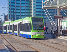 Public Transport and road user study with key focus on Journey Times on numerous routes, particularly those criss-crossing the Croydon Tram-link. Various survey methods used including in-vehicle moving-observer verification and number plate data, as well as determination of Origin-Destination Trips.
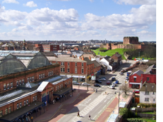 City-wide cross-matrix Origin-Destination study looking at key trips and journey times, principally using number plate data.
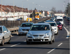 Rat-running study through a number of discrete residential zones identifying routes used and abused to avoid congestion on principal roads, as well as journey time information.
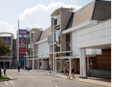 Junction and queue studies alongside car park utilisation and departure transition time, in and around strategic road network surrounding popular out-of-town retail park.
 Multi-modal study of road users and pedestrians, as well as origin-destination study of key radial routes.
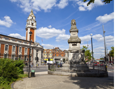 Borough-wide CPZ review of all parking stock in all zones, with production of interactive database for parking capacity queries.
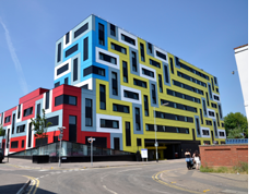 Assessment of key parking stock both on- and off-street including surface and multi-storey car parks, looking at capacity, utilisation, and duration of stay.
 Regional Distribution Centre Survey to enhance Pedestrian Safety.
 Open Land Survey for Flood Alleviation Scheme in Oxford.
 Major Parking Study for Local Centre Redevelopment in Hatfield.
 Abbey Road, Barking (London) Traffic Study for Major Redevelopment.
 Fosse Park (Leicester) Traffic & Queuing Study for Major Redevelopment and Road / Traffic Alterations.
 Whittle Arch, Coventry City Centre - Study of Breaches of Traffic Regulation Order and Impact on Pedestrian Safety.
 Meridian Leisure Car Park Study to explore scope of Additional Food/Leisure Units.
 Travel Plan Monitoring at Northstowe New Town, which will eventually accommodate more than 10,000 new homes.
 Travel Plan Monitoring on the Island of Havant for two new housing developments
 Parking Study for Redevelopment of Former Garages.
 Major Traffic Monitoring Study for the Southend VISSIM Traffic Model.
 VS Traffic completes extensive traffic and parking monitoring survey for the 2019 Field Day Festivals held at The Drumsheds in Tottenham London. Field Day is an outdoor music festival held annually since 2007 and formerly hosted continually at London’s Victoria Park until 2017. It was moved to London’s Brockwell Park for the 2018 Festival. The new ground-breaking 10-acre venue at The Drumsheds in Tottenham is an excellent venue as it is not only well-connected to public transport but is also far enough from residential areas to minimise noise disturbance. Traffic data collected by VS Traffic has been instrumental in monitoring traffic across Tottenham’s principal roads and designing appropriate road closures to ensure safety for pedestrians and traffic during the festival. Parking data collected by VS Traffic has been used to monitor the effect of the Festival on local parking across 53 streets” .
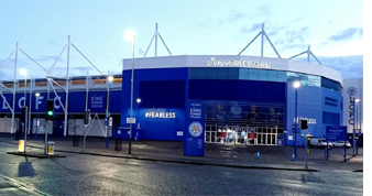 VS Traffic completes extensive traffic surveys around Leicester in support of plans to develop the King Power Stadium (Leicester City Football Club) into a world-class sporting and events destination. Leicester Mercury article here:https://www.leicestermercury.co.uk/sport/football/football-news/leicester-city-announce-next-phase-3191097.
 VS Traffic completes extensive traffic surveys in and around Brighton and Hove as part of the Brighton and Hove City Council Transport Model.
 VS Traffic delivers more parking surveys for clients in Bexley (London), Nuneaton, and Coventry. Clients approach VS Traffic for parking surveys for a range of developments including hotels, student accommodation, single dwelling houses and retail units..
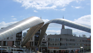 Whittle Arch, Coventry – this is an iconic landmark right in the centre of Coventry – next to the Coventry Transport Museum. Named after Sir Frank Whittle, who was an RAF officer credited for inventing the turbojet engine. Whittle Arch is also an important bus and taxi gate that shares its space with pedestrians. Unfortunately, many drivers abuse this gate: VS Traffic has carried out extensive traffic violation surveys at this location..
 VS Traffic has completed extensive surveys for Kirklees Council in Huddersfield and Dewsbury. Several junctions were covered, as well as Huddersfield Bus and Train Stations at which extensive pedestrian surveys were carried out. The surveys are all part of the Kirklees Multi-Modal Traffic Model, used by Kirklees Council to investigate the effects of changes in traffic and pedestrian levels, as well as to gauge the impact of present and future development.


